Vancouver to Tucson: A Thanksgiving Road Trip Log
This Thanksgiving, we traded the Vancouver rain for the desert sun of Tucson, Arizona. It was a massive undertaking—a family loop spanning nearly two weeks—but the route offered the perfect opportunity to test our range confidence.
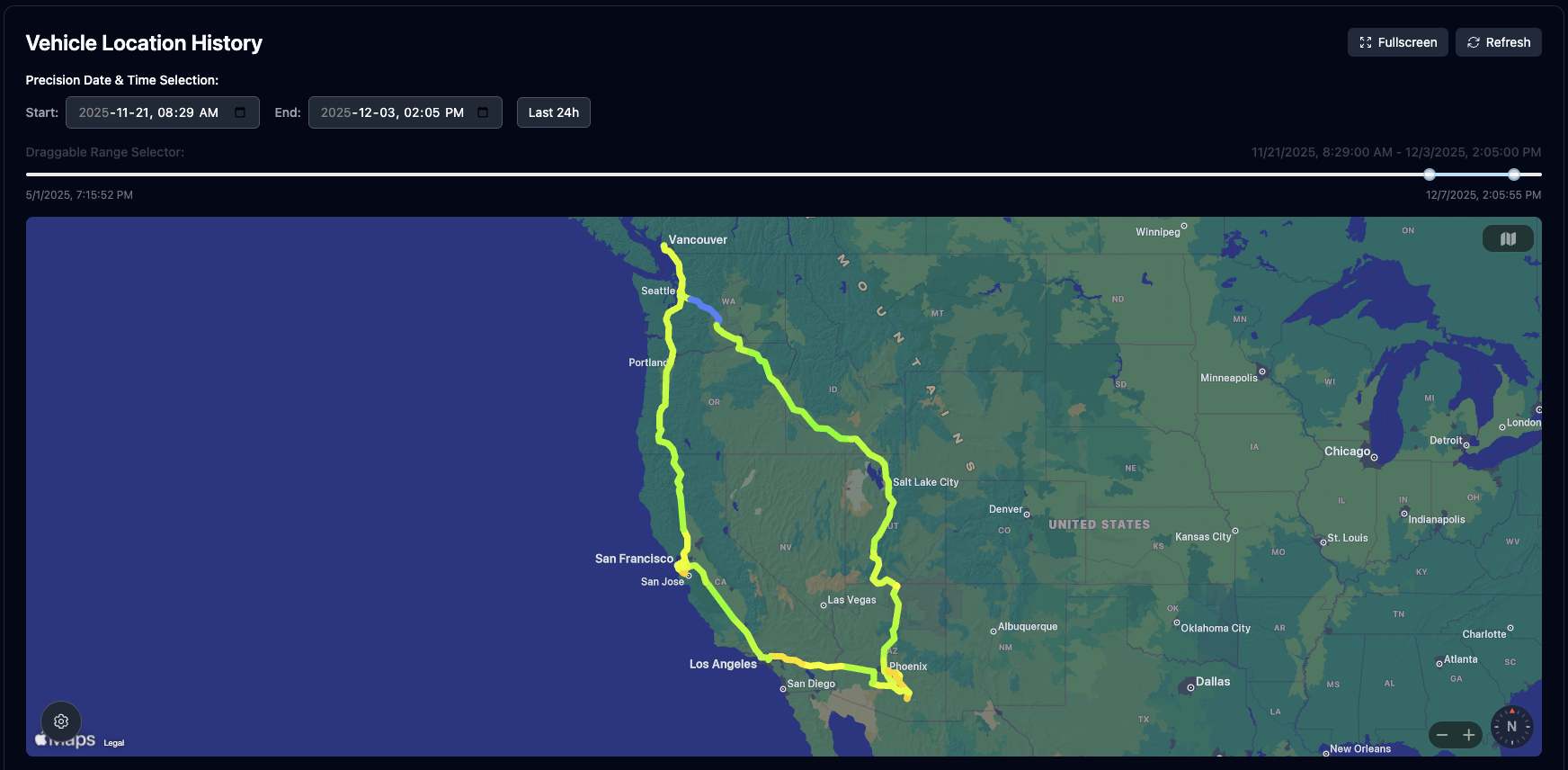
Looking at the Vehicle Location History map generated by TesDash (see above), you can see the massive "Great Western Loop" we carved out. I took the scenic interior route through Utah on the way down to ensure I made it in time for dinner, then hugged the coast on the return leg.
Leg 1: The Dash to the Desert
I made it to Tucson just in time for turkey. The drive down through the interior was all about efficiency. The speed and power data here was fascinating—watching the efficiency drop as we climbed through the passes in Utah and recovering energy on the long descents.
Leg 2: The San Francisco Pit Stop
After the holiday, we pointed the car west towards California. This detour was non-negotiable for one specific reason: The Mission District.
I met up with my friend Joshua and grabbed what might be the best quesadilla I've ever had at El Farolito in San Francisco.
On a normal trip, this memory might fade into "that Mexican place we stopped at." But with TesDash's high-frequency telemetry, I can see exactly when we parked, how long we stayed (45 minutes of pure bliss), and the precise GPS coordinates. That memory is now pinned to my digital map forever.
The Insight
It's one thing to drive a loop like this; it's another to see the physics of your journey visualized. Comparing the energy consumption of the high-speed interior highways on the way down versus the stop-and-go traffic of the California coast on the way back gave us a completely new perspective on how we drive.